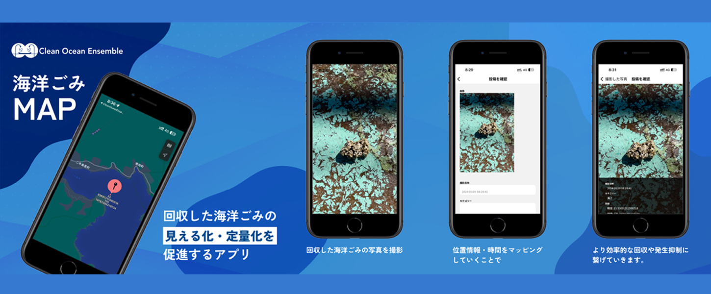
Quantifying Marine Debris
Marine Debris MAP is a platform to “visualize” collection activities around the world.
It is operated in two parts: a smartphone application that allows users to upload collected images, and a web version that visualizes the images on a map. The system in which activity records are easily posted on the app and data is shared in real time on the web version leads to a better understanding of the status of collection and an increase in the number of supporters. This makes it a revolutionary tool for data-driven solutions to the marine debris problem.
Composition of Marine Debris MAP
Application
- Smartphone application for easy uploading of marine debris photos and information
- Easy sharing of activity data by recording location information, amount collected, and type
WEB MAP
- Map tool that allows you to see at a glance the status of collections around the world based on uploaded data
- In addition to analyzing the volume and type of collections by region, a search function makes it easy to find specific data
Marine Debris MAP Application
The app is a tool for easily uploading marine debris collection photos and information. Location information, amount collected, and type are recorded, and activity data can be easily shared. The intuitive design allows anyone to operate the app and incorporate environmental conservation activities into their daily lives. In addition, the posted contents are reflected in the web version in real time, allowing users to connect with activities around the world.

Marine Debris MAP for WEB
The web version is a tool that visualizes uploaded data on a map and allows you to check the status of collections around the world at a glance. In addition to analyzing the amount and type of collections by region, the search function makes it easy to find specific regions and data. This makes it easy to keep track of the progress of activities and issues, and can be used as a place to increase supporters and plan effective environmental measures based on the data.


